

Gora Zmeinaya
14.6 km63
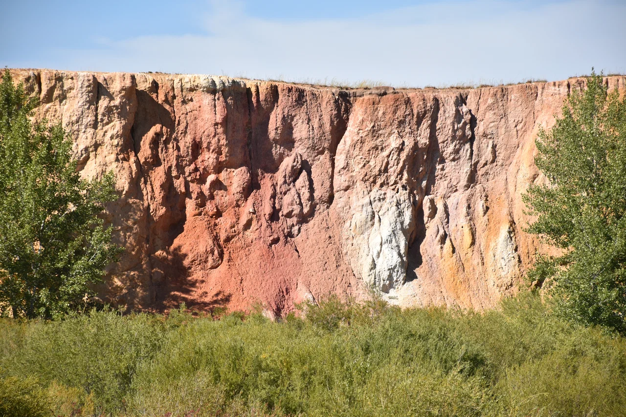
Semitsvetka Cliff (Обрыв Семицветка) is located in the Adamovsky District of Orenburg Oblast, on the right bank of the Zhaman-Akzhar River, about 2 km downstream from the village of Rechnoy. It is a regional geological nature monument covering roughly 8 hectares, known for its multicoloured clay layers, which gave the cliff its name.
The cliff rises up to 20 metres. It is composed of clays mixed with siliceous flour (marshallite), coloured in a wide range of shades: red, pink-white, white, cherry, crimson, lilac, brown, greenish-grey and various shades of ochre. This richness of colour is the source of the local name "Semitsvetka" ("seven colours"), even though the actual number of shades visible here is noticeably higher than seven. Local journalists have described a visit to the cliff as "touching a rainbow," conveying the impression its striped, colourful layers make on visitors.
The multicoloured clays belong to river and lake deposits of the Mesozoic era and formed more than 70 million years ago. At that time the climate in these latitudes was subtropical to tropical: heat and abundant moisture accelerated chemical reactions that released iron compounds, which became the natural pigments of the rock. In most places in the Urals such Mesozoic deposits were later washed away and destroyed, but here they survived thanks to karst processes: the colourful clays slumped into a large ancient limestone karst sinkhole, as if into a natural safe, which protected them from erosion. As the ground collapsed, the horizontal clay layers were strongly deformed — in places they sagged, in others they tilted almost vertically, and elsewhere they were shattered; all these deformations are still clearly visible on the cliff today.
Semitsvetka Cliff is a reference geological section of loose Mesozoic deposits dating to a period of intensive placer formation in the Urals. During that era many rocky formations rapidly broke down into clay under chemical weathering, while resistant minerals — gold, diamonds, platinum, rock crystal — survived and accumulated in ancient stream beds. Because of this, the cliff is valuable not only as a scenic site but also as a source of information about the formation and location of gold-bearing and other mineral placers of the Southern Urals.
The cliff lies in the Adamovsky District of Orenburg Oblast, 2 km downstream from the village of Rechnoy along the Zhaman-Akzhar River. The village of Rechnoy is the most convenient starting point, with the rest of the way following the riverbank.
No votes yet


No reviews yet. The first one helps the next travellers.