

Екатериненский мост
3.08.5 km10.2k4
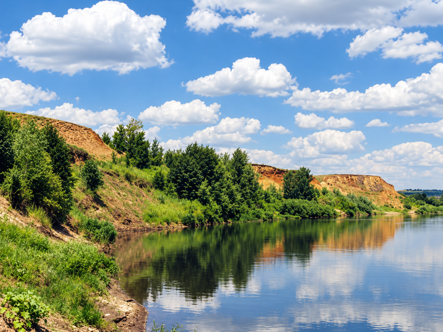
Bereg Sokrovishch (Treasure Shore) is a geological and landscape nature monument in the Perevolotsky district of Orenburg Oblast, on the right bank of the Ural River between the villages of Zubochistka Pervaya and Zubochistka Vtoraya. It lies about 80 kilometers from Orenburg. Local residents call the site Yar-Bue-Baylyke, which translates from Tatar as "treasure shore" — a name given not by tour guides but by people living in the nearby villages themselves.
The roughly eight-hundred-meter-long bluff formed in the late 1940s, when the base of a hill was eroded by water and sandy-clay deposits slid down the slope as a landslide. The slope has kept shifting ever since, and it now shows alternating multicolored sands, clays of different shades, marls, calcareous tufa and ochre scree.
At this stretch the Ural valley crosses a down-dropped block of crust about a kilometer wide, known as the Zubochistensky graben. The depression is bounded on both sides by layers of red-colored and variegated Permian rock tilted in opposite directions, so rocks of very different age and composition — from 50 to 130 million years old — come to the surface side by side. The exposures show Jurassic and Cretaceous deposits together with rocks of the Permian Tatarian stage. In one spot a vertical tectonic contact is visible between Jurassic-Cretaceous sandstones, sands and clays and Permian sandstones; calcite crusts, pyrite and pilonite occur along the contact line.
On the northern edge of Zubochistka Vtoraya village, a sand quarry has exposed another fragment of the graben: a fault between red-colored Permian sandstones and mudstones and yellowish-white Middle Jurassic sands. The fault plane dips almost vertically, and its zone, up to 0.5–0.6 meters thick, is made of limonitized sand with calcite veinlets.
On the collapsed southern slope that runs down into the water, numerous fossils from the Cretaceous sea are scattered — ammonites, belemnites, oyster shells, as well as fossilized tree trunks. At the foot of the northern part of the landslide, nodules of iron sulfide (pyrite) can be found; glauconite and other minerals also occur in the exposures.
Nearby, in the Ural riverbed, lies the Zubochistenskaya wintering pit — up to 10.5 meters deep and about a kilometer long, the deepest pit in the middle course of the river.
Numerous springs with water of varying chemical composition flow out on the landslide slopes. They feed small "hanging" marshes overgrown with reeds, cattails, purple loosestrife and sedges, which hold deposits of dry peat up to half a meter thick. A large black alder once grew on one of the landslides; young alder saplings now grow in its place, while other slopes hold scattered poplars and willows. Fresh landslides that have moved recently are covered with typical steppe vegetation.
The site is cut by two shrub-covered ravines. In the northern one, the deepest and steepest, snow lingers in the niches almost until mid-July, and on hot summer evenings cool air flows from its mouth toward the river, carrying the scent of steppe herbs.
Bereg Sokrovishch received the status of a regional nature monument in 1998; the protected area covers 8 hectares. A special protection regime applies here, and details on permitted and prohibited activities can be found on the Orenburg Oblast government portal. At the same time, the site suffers from unfavorable human impact: construction on the slopes, extraction of sand and gravel and chalk, and littering of the beaches with household waste.
From Orenburg, drive west along the highway toward Buzuluk and Samara to the district center of Perevolotsky, then head south to the village of Zubochistka Pervaya. Just past it, before reaching Zubochistka Vtoraya, a turn to the left leads to Bereg Sokrovishch.
The village of Zubochistka Pervaya was founded in 1795 on the bank of the once full-flowing Zubochistenka stream (other sources say 1801, by Karagalin Tatars); before the revolution it was a Cossack stanitsa. Zubochistka Vtoraya arose in 1801–1803, settled by Tatars from the Sterlitamak district, or, by another account, by people from Zubochistka Pervaya. By the early 20th century the village had 276 households, about 1,700 residents and two mosques. The Tatars of the two villages belong to different groups — Mishars and Talyaki — and their dialects differ slightly.
No votes yet


No reviews yet. The first one helps the next travellers.