

Место авиакатастрофы Ли-2 (Таганай)
5.02.9 km6.9k2

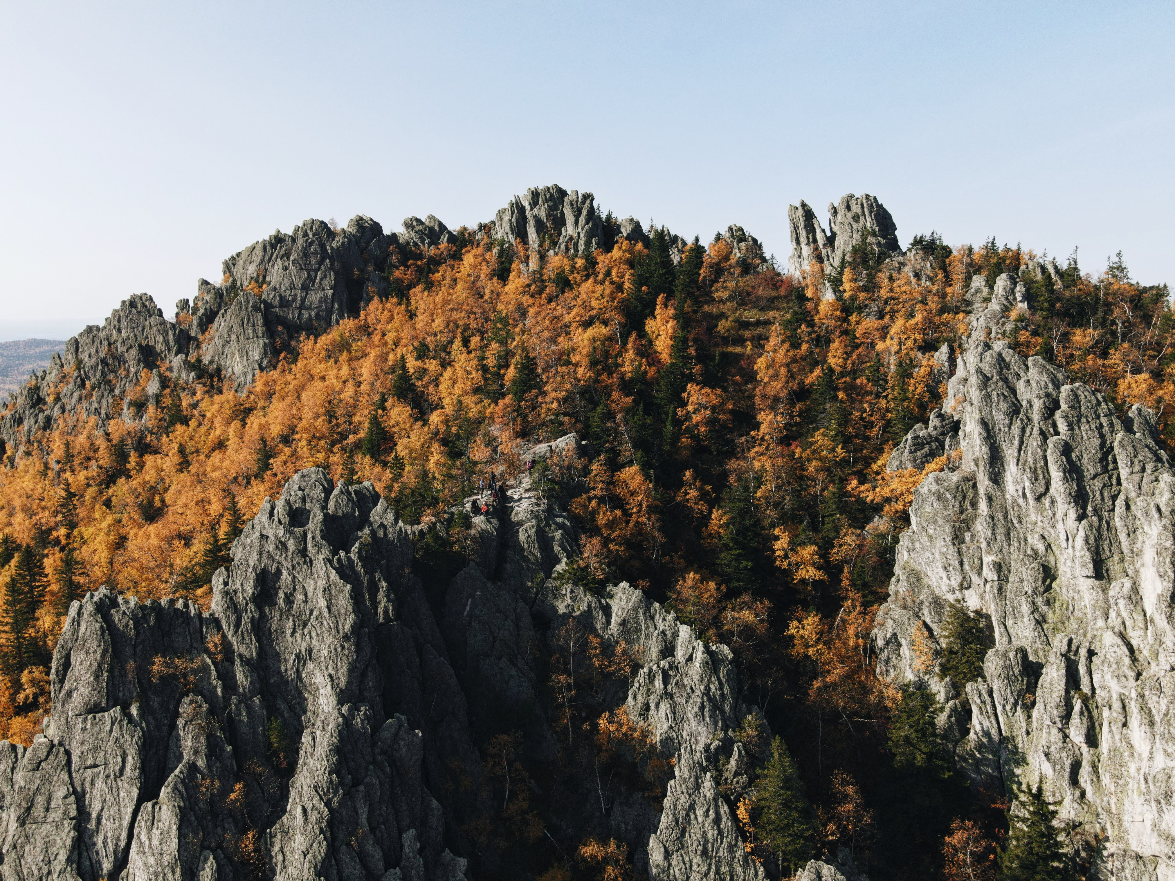
Dvuglavaya Sopka, the Two-Headed Hill, is the southernmost peak of the Bolshoy Taganay ridge in Taganay National Park, about 13 km north of Zlatoust in Chelyabinsk Oblast. It is one of the most visited mountains in the park: people climb it all year round, and the hike from the park's main visitor centre fits into a single day.
The hill was named by the South Ural explorer V. P. Sementovsky because its top is split in two. The northern summit, 1,041 m high, is a curved ridge running to the south-east, made of terraces, rock walls and crevices with smooth dome-shaped rocks; hikers call it the Rams' Foreheads, locals the Right Side of Taganay. The southern summit, Perya (the Feathers), is slightly lower at about 1,034 m and takes its name from its sharp rock spurs; rock climbers often scramble on it.
The hill is built of white quartzite with lenses of aventurine, an ornamental stone that was quarried on the south-eastern slope in the 19th century. The slopes are covered with boulder fields, while alpine meadows, crooked birch woodland, alpine knotweed and bilberry grow on the south and south-west. The western and southern slopes drop into the valley of the Bolshaya Tesma river, the eastern one into the valley between the Bolshoy and Sredny Taganay ridges. There are many springs at the foot: the best known is Bely Klyuch (White Spring) on the south-eastern slope, and the Gremuchiye springs lie along the way.
In the late 1950s and the 1960s Zlatoust's first television relay stood on a small platform just below the top of Perya. Remains of its metal mast can still be seen. Taganay National Park, which includes the hill, was established in 1991.
Both summits offer an all-round panorama: Zlatoust, the Great Stone River, the Otklikny Ridge and Kruglitsa to the north, and the whole of Taganay. On the southern slope stands the Skalodrom, a large rock outcrop resembling a Gothic cathedral, used by climbers for training.
The starting point is the park's Central Estate visitor centre on the edge of Zlatoust. From there the Upper Trail, marked in white and blue, climbs almost all the way for about 6.5 km to the Bely Klyuch shelter. Two routes then lead to the top.
The first goes past the Skalodrom: turn at the sign about 1.5 km before the Bely Klyuch shelter. This path is quieter and runs through forest and alpine meadows, with views of Zlatoust higher up.
The second starts at the Bely Klyuch shelter itself with a long iron staircase, followed by a climb up the slope. It is steeper, but the trail is easy to follow.
The day hike there and back is about 14 km and takes 6 to 8 hours. It is often combined with the Great Stone River.
Entry to the national park is paid: you need a permit, issued online or at the visitor centre, with concessions for some visitors. Walking is allowed only on marked trails, dogs are not admitted, and brown bears live in the park. The trail turns muddy after rain and the Skalodrom route is snowed over in winter, so wear hiking boots and bring a rain jacket, warm layers and water: it is usually windy at the top. For an overnight stay there are the Bely Klyuch and Gremuchy Klyuch shelters with cabins, tent pitches and bathhouses; in summer it is best to book in advance.
No votes yet


No reviews yet. The first one helps the next travellers.