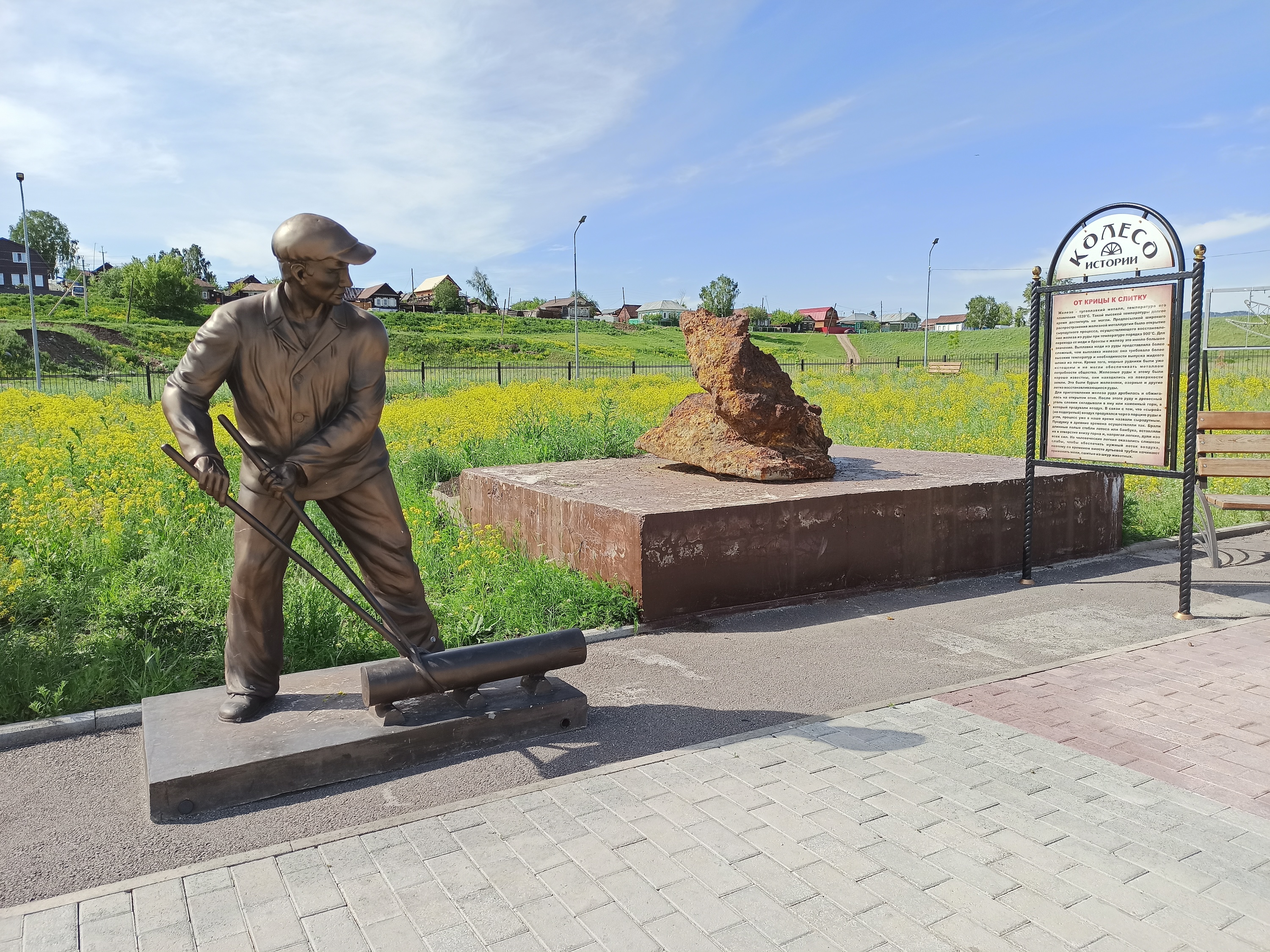
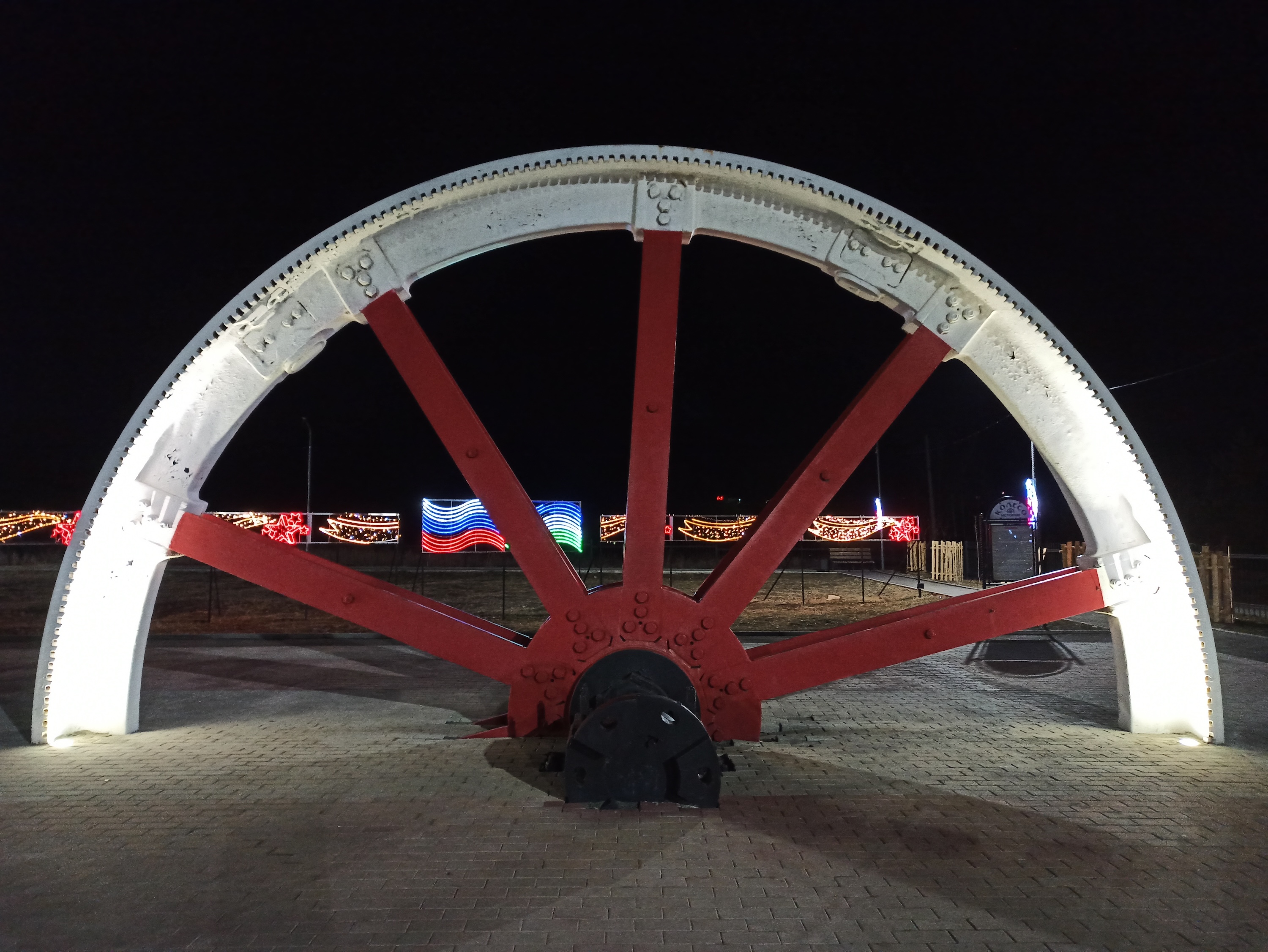
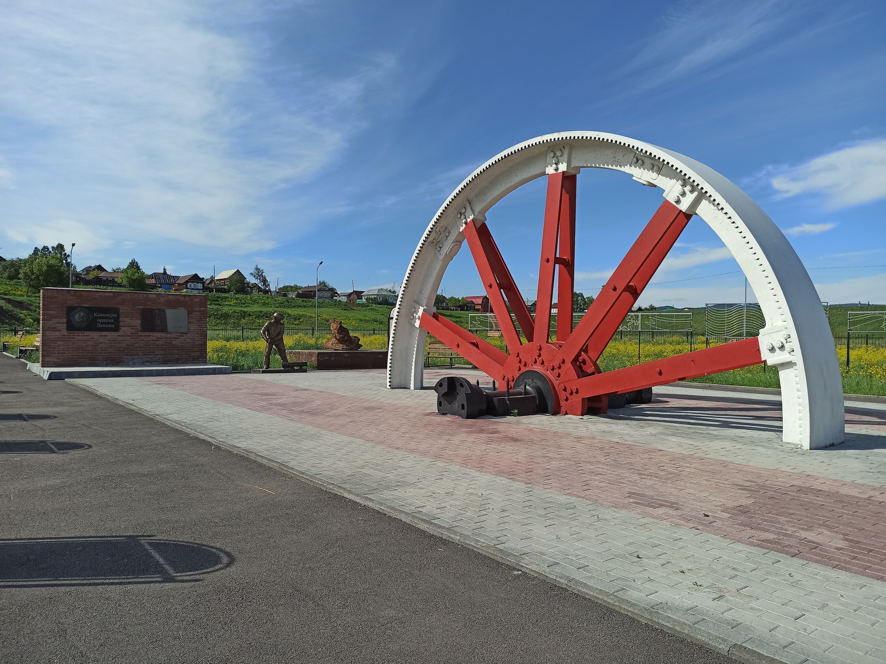
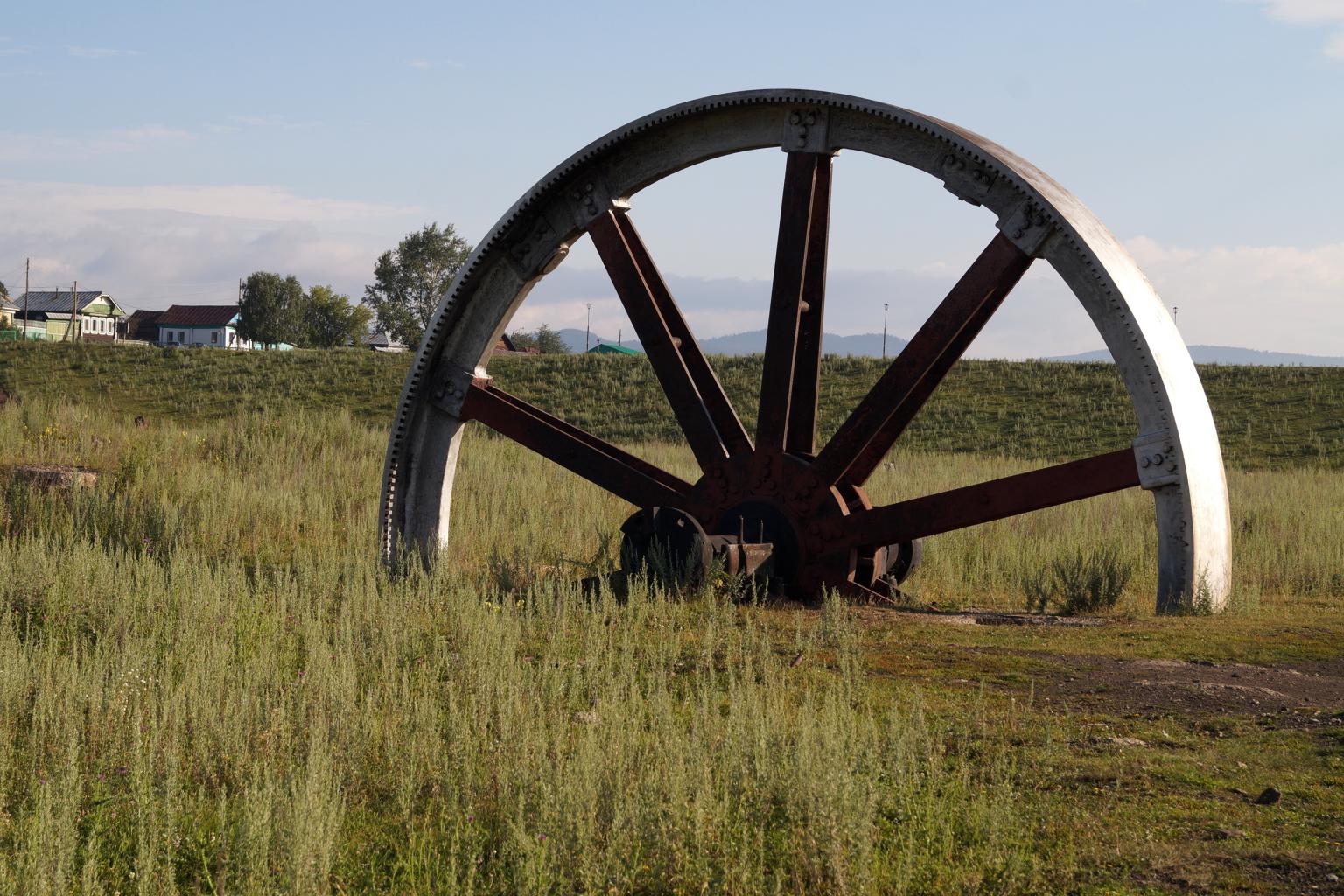
Металлургический завод имел свою историю с XVIII века до начала 1990-х годов. Начало его истории связано с 1740-ми годами, когда купцы Иван Твердышев и Иван Мясников приняли решение о строительстве завода по плавке чугуна и железа на землях, находящихся на реке Тирлян. Однако строительство было прервано из-за недостаточного водоснабжения, и в 1761
Колесо-маховик прокатного цеха
- Category:
- Author:
- Views:3446
- Отредактировано:June 30, 2018, 11:08 PM
- Coordinates:
Photos
Description
Колесо-маховик прокатного цеха являлось частью разрушенного наводнением 1994 года Тирлянского металлургического завода. Высота колеса - около 10 метров, вес - около 100 тн
Comments
Название "Инзерские зубчатки" носит один из горных хребтов, расположенных на Южном Урале на территории Белорецкого района Республики Башкортостан. Горный хребет расположен между двумя горами - Яман-тау и Иремель. Он получил свое название от реки Инзер, вдоль которой протянулись на несколько километров высокие скальные вершины, называемые
The Yuryuzan railway station, located on the former Beloretsk narrow-gauge railway, is evidence of the history of transporting the products of the Beloretsk Iron Smelting Plant at the beginning of the 20th century. The station, although now dilapidated, is a reminder of the times when the narrow gauge railway was an important part of the region's i
Каменная река Курум - большая каменная россыпь, одно из удивительных природных явлений гор Урала. Представляет собой нагромождение огромных каменных глыб весом от сотен до тысяч килограмм каждая. Образовалась данная река в результате разрушение гор. Камни с течением времени постепенно сползали вниз по горным склонам и образовали россыпь в виде каме
Гора Малиновая - это даже не одна вершина, а хребет с тремя ярко выраженными вершинами, с максимальной высотой 1152 метра. На башкирском ее название звучит как Елэкташ - "Ягодный камень". Расположен этот Малиновый хребет в 6 км от Белорецка, и отлично виден с северных склонов ГЛЦ "Мраткино". Подъем несложный - тропинка ведет чер
Ivan Borisovich Tverdyshyov, born in 1690 in the city of Simbirsk, made a significant contribution to the development of the region's industry. His biography is closely associated with the establishment of the Voskresensky copper-smelting plant and the Preobrazhensky metalworking plant, which became important industrial enterprises and brought pros
Mount Yamantau, whose name comes from the Bashkir "Yaman tau" - "bad (evil) mountain", is the highest point of the Southern Urals. It is located in the Beloretsky district of the Republic of Bashkortostan and is part of the South Ural Nature Reserve. The mountain has a height of 1640.4 meters above sea level and is surrounded by no less interestin
At the top of the mysterious Mount Yamantau there are the ruins of a geological station, which are a kind of evidence of the activities of geologists and the military in this place. Despite its importance, the station has now become a caravan of machinery and equipment left here after the completion of work. Debris from the drilling rig, pieces of
The territory of the former military unit No. 12764, located under Mount Yamantau, arouses interest and controversy among researchers and the public. The military personnel who served in this unit were not completely clear about its purpose. The main task was to ensure the safety of the mines and adits into which workers descended every day. Howev
Blue Rocks get their name from a feature that can sometimes be seen at dawn when the rocks take on a bluish tint. The name of Mount Arvyakryaz, according to local legends, is associated with the Kulsugada River, which begins near the top of the mountain, and the word “tash”, which in the Bashkir language means stone or rock. The Kulsugada River als