 Viewpoint


Пещера Миндигуловская
3.08.2 km8.3k5
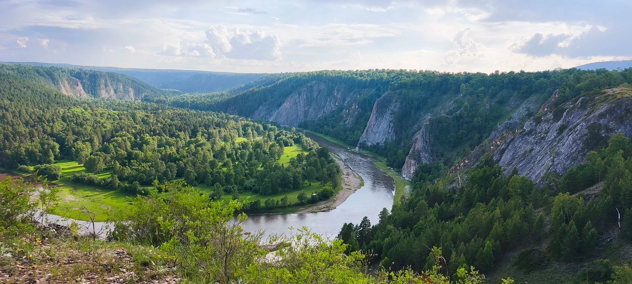
The viewpoint sits on top of a cliff right at the entrance to the village of Ishdavletovo in the Burzyansky District of Bashkortostan. The road leads straight to the edge of the rock, and from the platform opens a panorama of a sharp bend of the Belaya River (Agidel), forested slopes and the vast expanses of the Burzyansky land.
Below, the river makes a sharp turn around a rocky bank, surrounded by forested ridges typical of this part of the Southern Urals. Rafters on the Belaya River get a good view of the Bolshoy and Maly Amphitheatre rocks, and near the village there is another notable rock group known as "Three Brothers."
The village was founded in 1816 by twenty families who came from the Yamashly River, from the village of Chingizovo (now in the Baymaksky District). In 1859 it had 134 residents in 19 households, and by 1920 the population had grown to 267 people in 53 households. According to the 2002 census, the entire population of the village were Bashkirs, and by 2010 only 29 residents remained in Ishdavletovo — like many other villages in the Burzyansky District, it has noticeably emptied out over the past century. Today the village has a tourist base called "Bashkort Ile," which hosts visitors coming to see the Belaya River and the surrounding cliffs.
The Burzyansky District, where the village stands, is one of the centers of rafting and cave tourism in the Southern Urals: nearby on Geometki are marked the Mindigulovskaya, Timirovskaya 2 and Propashchaya Yama caves, so the viewpoint often becomes one of the stops on a route through these places.
According to one Bashkir legend, the Agidel River was born from the water that followed Idel, the son of the hero Ural-batyr, as he walked south, leaving deep tracks in the ground — and that is how the riverbed came to be.
The viewpoint is located right at the entrance to the village of Ishdavletovo: the road leads a traveler straight to the edge of the cliff. You can drive to the platform without any hiking, though those who prefer can walk about 2.5 km from a point on the approach to the village to the platform itself.
No votes yet


No reviews yet. The first one helps the next travellers.