

Заброшенная штольня Р-39
5.01.7 km6.9k1
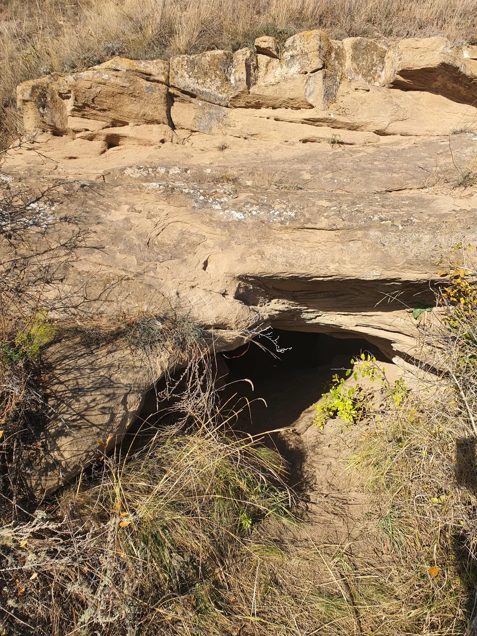
Kargalinskie Rudniki (the Kargaly copper mines) is a landscape-historical reserve in the south-western part of Oktyabrsky District, Orenburg Region, in the upper reaches of the Kargalka River and its tributaries, near the villages of Uranbash and Komissarovo. The reserve covers 1,298 hectares and combines several tracts with traces of ancient and old copper workings; since 1995 it has held the status of a federal heritage monument.
Copper ore was first mined here as early as the late 4th to early 3rd millennium BC. For almost two thousand years, in the 3rd and 2nd millennia BC, local copper was used to make tools — axes, hammers, knives, daggers, spearheads — as well as jewelry: bracelets, earrings and pendants. The ancient workings were later abandoned for a long time.
A new rise began in the mid-18th century. After Empress Elizabeth's decree creating Orenburg Governorate in 1744, the merchants Tverdyshev and Myasnikov received the right to develop Kargaly and built the first copper-smelting plant here. Within a quarter of a century, mining had grown so much that Kargaly ore supplied up to a quarter of all the copper of the Russian Empire, with annual output reaching 3 million poods of ore.
By the late 19th century the deposits were exhausted and the companies that owned the mines fell into decline: in the mid-1880s output dropped to 3,000 poods a year, the Voskresensky plant closed in 1895, and the Verkhotorsky plant held out longest. The official end date of mining at Kargaly is considered to be 1913. According to workers' recollections, in 1916 some rich workings, such as the Kuzminsky shafts, were still active, but the owner Pashkov ordered the deep galleries to be caved in.
The old workings are tied to a legend about the love of mine foreman Andrei Shavrin and Nastya Ferapontova, a carpenter's daughter, as told by an old-timer named Polenov. The story has been passed down among local residents as part of the memory of the mines.
The reserve's tracts occupy the watershed part of the Obshchy Syrt upland; the terrain here is typical syrt relief — with gentle asymmetric ridges separated by ravines. The old workings left behind spoil heaps — piles of waste rock that stand out from a distance on the steppe slopes as bluish-green patches — and sinkholes from collapsed shafts and adits, often overgrown with steppe cherry bushes. Geologically the strata consist of sandstones interbedded with mudstones, siltstones and limestones, which contain the copper minerals malachite and azurite. In 1929 the writer and paleontologist Ivan Yefremov visited these places and later described the landscape in his story "Along the Paths of Old Miners".
Kargalinskie Rudniki can be reached from Orenburg along the R-239 highway toward Tatarskaya Kargala, then through the settlement of Svetly toward the village of Komissarovo, or via the village of Bulanovo. From Komissarovo a hiking route of about 15 kilometers leads to the mines.
No votes yet


No reviews yet. The first one helps the next travellers.