

Cave City (Seven Caves)
7.9 km1.6k2
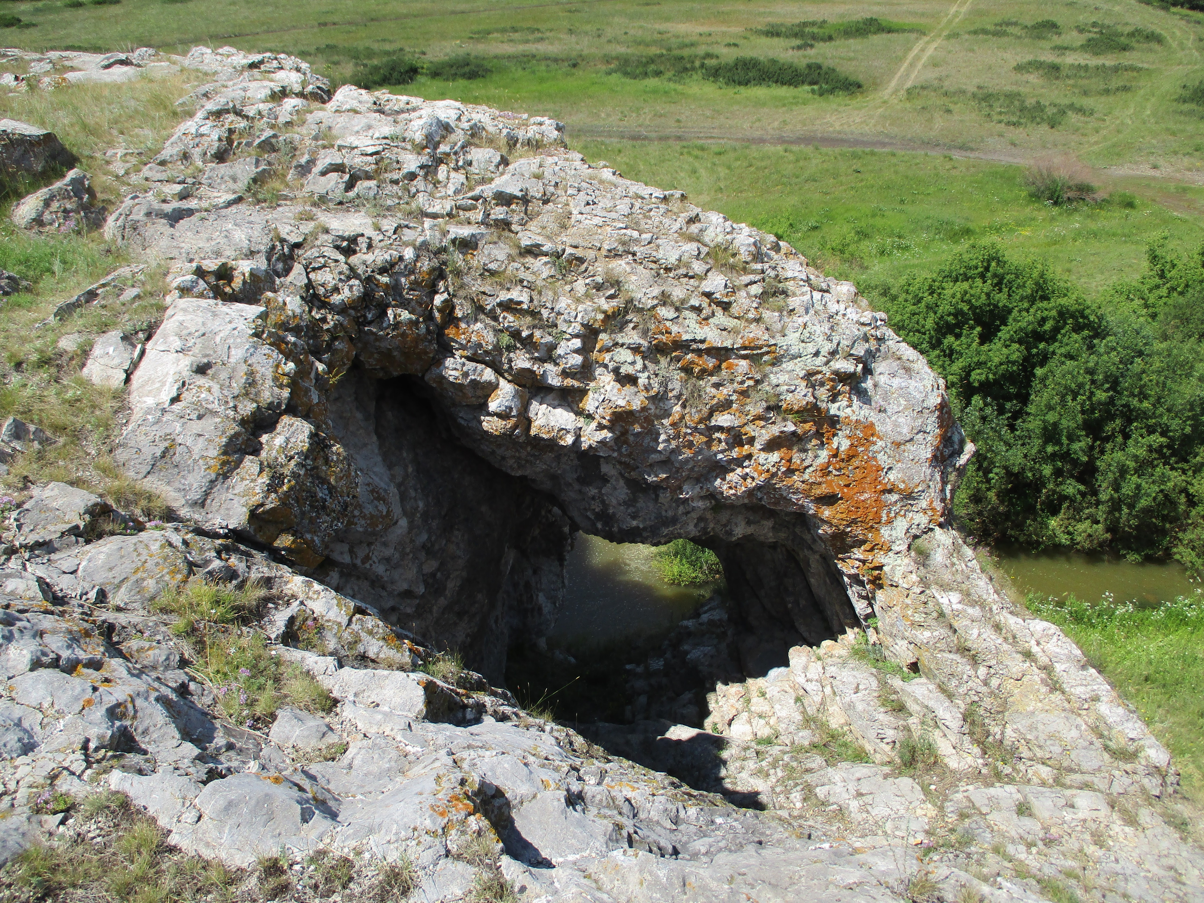
Koltso Rock (Skala Koltso, "Ring Rock") is a limestone crag with a natural arch on the Khudolaz River in the Kizilsky District of the Chelyabinsk Region, not far from the village of Novopokrovsky. It stands right by the border with Bashkortostan (Baymaksky District); because of the large opening through the stone it is often called Koltso Cave, although it is really a natural rock arch.
Here the Khudolaz, a tributary of the Ural, makes several sharp bends and loops around the rock massif. The rock is built of layers of limestone. About 20 metres above the water a large opening cuts right through it: the stone forms a solid arch, and from a distance the opening looks like a huge eye turned towards the valley. The rock owes its name to this ring-like shape. It is one of many natural sights of the Kizilsky District, and among the surrounding crags it stands out precisely for its through opening.
According to local historians, the rock has three openings. The main one, which goes right through, is clearly visible from the river, while one of the openings is now buried under loose deposits.
The rock is worth seeing from two points. From below, on the bank, you see the arch above the bend and the meander of the Khudolaz itself. From the top of the ridge there is a view of the winding river bed, the neighbouring crags and the surroundings on both sides of the border. People from the Kizilsky District, by their own accounts, like to climb to the top with a thermos and drink tea there while looking over the valley.
On the riverbank below the rock there are flat clearings used for picnics and camping.
The nearest town is Sibay in Bashkortostan, about 7 km from the rock in a straight line. On the Chelyabinsk side the landmark is the village of Novopokrovsky in the Kizilsky District. The rock rises right above the river, so the easiest way is to follow the Khudolaz valley: the river loops around the massif, and the arch can be seen from the bank from far away. Depending on the route you may have to ford the Khudolaz, so after rain or during the spring flood it is best to check the water level in advance.
No votes yet


No reviews yet. The first one helps the next travellers.