 Mountain

Ruins of a Japanese Temple in Lesogorskoye
302.2 km1
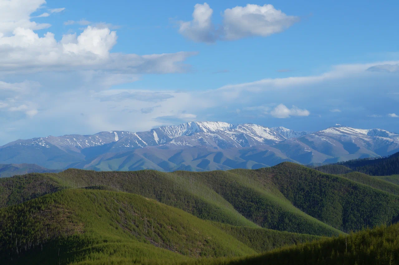
Tordoki-Yani, also known as Tardoki-Yangi, is the highest peak of the Sikhote-Alin range, located in the south-eastern part of the Nanaysky district of Khabarovsk Krai, just north of the border with Primorsky Krai. The mountain rises to 2090 meters above sea level. The Anyui River, which flows into the Amur between Khabarovsk and Komsomolsk-on-Amur, originates on its slope.
The summit itself is a remnant peak standing between three closely spaced, almost merging cirque niches at the headwaters of the Bomboli River. The rise above the cirque floors reaches about 500 meters, and above the Anyui valley more than 1600 meters. On the northern slopes of the massif, cirque niches from the last glaciation period have survived: glaciers once lay here, and what remains now are small moraine-dammed lakes — Bolshoye, Verkhneye and Marinkino.
The upper forest boundary on Tordoki-Yani runs at roughly 1400 meters. Above it stretches a narrow belt of dwarf Siberian pine, and higher still begins a zone of mountain tundra, rock fields, scree slopes and bare rock. In the surrounding cedar-spruce forests the understory is formed by Fauriei rhododendron, and the overall flora has a Manchu-Okhotsk character with a predominance of Manchurian species. Rocky ecosystems occur in the nearby mountains as well, including the Abrek tract, home to the goral.
Along the Anyui River, which begins on the slope of Tordoki-Yani, salmon, lenok, grayling and taimen are found, and autumn chum salmon and pink salmon come here to spawn. Wapiti deer, lynx, wild boar, moose and roe deer live in the surrounding area.
In Nanai, "Tardoki-Yangi" translates as "snowy peak". The summit is considered a hard-to-reach one, with a narrow and winding trail, and is known above all among hikers from Primorsky and Khabarovsk Krai, who regularly climb it with guides, including guides from the region's indigenous peoples.
The first documented ascent by a group of tourists to Tordoki-Yani was made by an expedition of the "Veter Peremen" (Wind of Change) club on July 23, 2019 — exactly a year after a first attempt to reach the mountain. At the summit, the group's GPS receiver showed an elevation of 2097 meters, slightly above the official 2090 m.
On the fourth day of the climb, the group visited the crash site of a Li-2 aircraft that went down here in 1955, killing 21 people. Climbers also leave entries in summit log books — groups from Primorsky Krai have left their marks here as well.
The mountain and the route to it have been the subject of several documentary videos made in the 2020s, covering expeditions with Udege guides retracing places once explored by Vladimir Arsenyev, and ascents by geologists from Khabarovsk.
The mountain is reached via the Lidoga–Vanino highway: at kilometer 201 a turn leads onto the Arkaima road. From the turn to the checkpoint is about 30 kilometers, and another roughly 30 kilometers separate the checkpoint from the tourists' parking spot. A pre-arranged pass is required at the checkpoint.
From there the route continues on foot: the trail crosses the Sagdy-Biosa River several times, mostly over fallen logs, occasionally by wading when the water is high. The trail itself is littered with deadfall, sometimes disappears and branches, so hikers navigate by old white tape markers.
The first base camp is usually set up at around 834 meters, in a waterlogged area with few flat spots for tents. The second base camp sits at about 1447 meters, at the upper edge of the dwarf pine belt, roughly six kilometers from the first. The final ascent to the summit begins from here.
Weather on the route is changeable: rain, snow and fog are possible even in summer. Climbing Tordoki-Yani requires a multi-day trek, good physical preparation and, as a rule, an experienced guide familiar with the terrain.
No votes yet


No reviews yet. The first one helps the next travellers.