

Iken Cave
22.3 km6.8k5


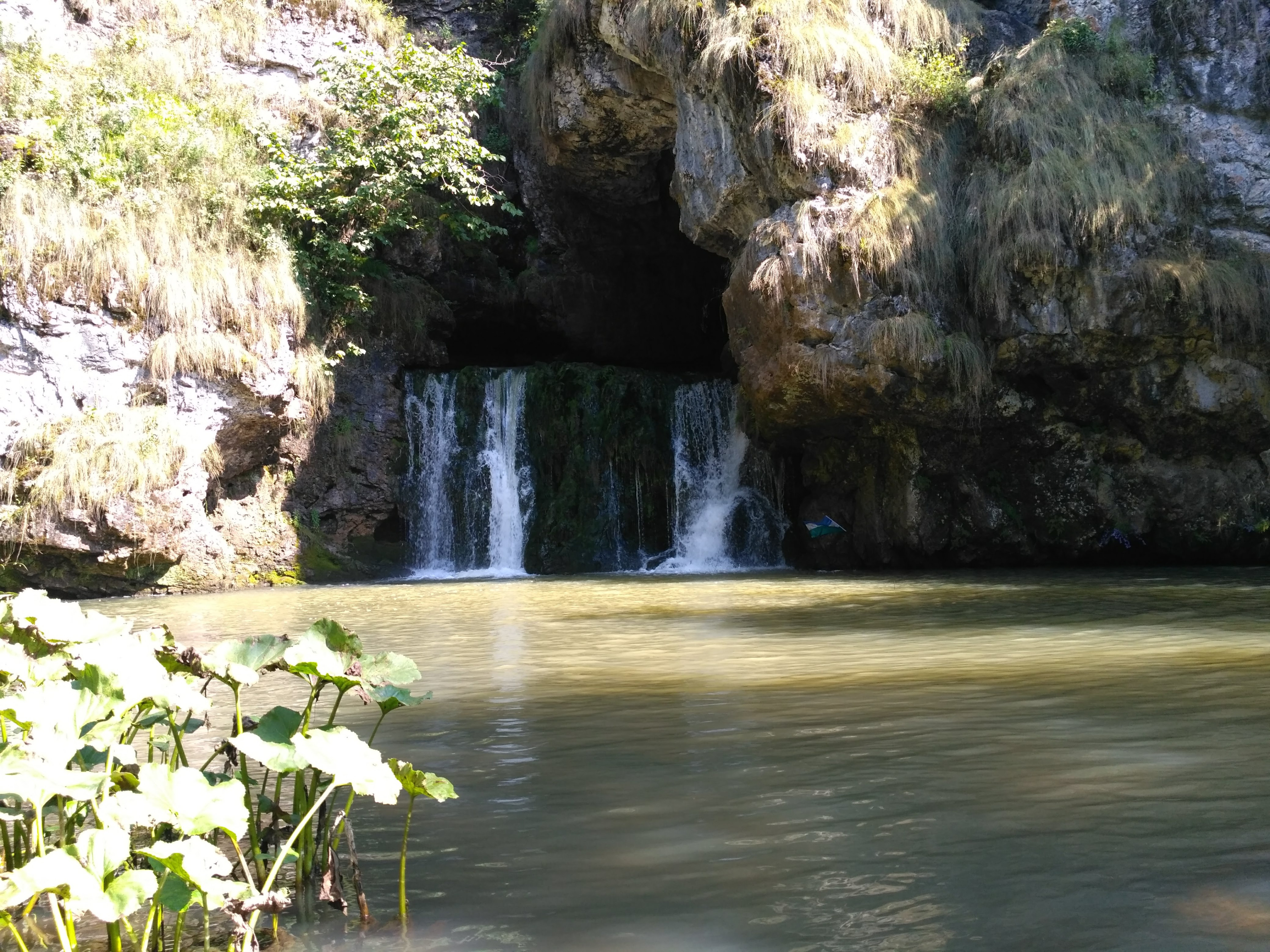
Atysh Waterfall is the outlet of an underground river from a grotto in Mount Yash-Kuz-Tash, in the Beloretsky District of Bashkortostan, on the Lemeza River. It is the only waterfall in the Southern Urals that "shoots" straight out of a cliff: inside the grotto, water bursts from an inclined opening in a powerful upward jet about 6 m wide and 4.5 m high — hence the name, "Atysh," which means "shot" in Bashkir. This is especially striking in spring, when the stream of water seems to shoot out of the rock.
At the foot of the cliff the water has carved two plunge pools about 20 m across and 7-10 m deep; the lake beneath the waterfall has a turquoise tint and is about 7 m deep. Wagtails and dippers often perch on the rocks by the waterfall. The Atysh River flows out of the lake and joins the Lemeza River a few hundred meters downstream.
The mountain where the waterfall is located is made of limestone some 570 million years old. The Aguy and Atysh rivers, flowing through a zone of soluble Lower Carboniferous limestone, disappear into sinkholes and resurface several kilometers later as a waterfall; the Bashkirs call the spot where the Atysh River goes underground "Atysh-Sumgan" — "Atysh has fallen through." The underground river cuts through the upper part of the mountain and emerges on its slope, becoming part of the bedrock bank of the Lemeza. Several other caves and sinkholes lie near the waterfall, including Zapovednaya Cave (Reserve Cave).
Atysh Waterfall is a protected natural monument: the status was granted on August 17, 1965, and the protected area covers 6.6 hectares. Mixed broadleaf forest grows around it.
A road leads to the waterfall from the bank of the Lemeza River, so in summer and dry weather it can be reached by an off-road vehicle. Hikers usually set out from Inzer station or the "71st Kilometer" commuter-train stop (on the Ufa–Inzer line): they ford the Inzer River, cross a ridge and descend to the Lemeza, which also has to be forded, then follow the bank to the waterfall. The route crosses forest and fords, so it is worth setting aside a whole day and bringing a change of footwear.
Today Atysh Waterfall is one of the most popular spots among lovers of Bashkortostan's natural scenery, although signs of tourist pressure on the environment can be seen nearby.
No votes yet


No reviews yet. The first one helps the next travellers.