 Waterfall


Kholomki Estate
108.5 km1.3k4
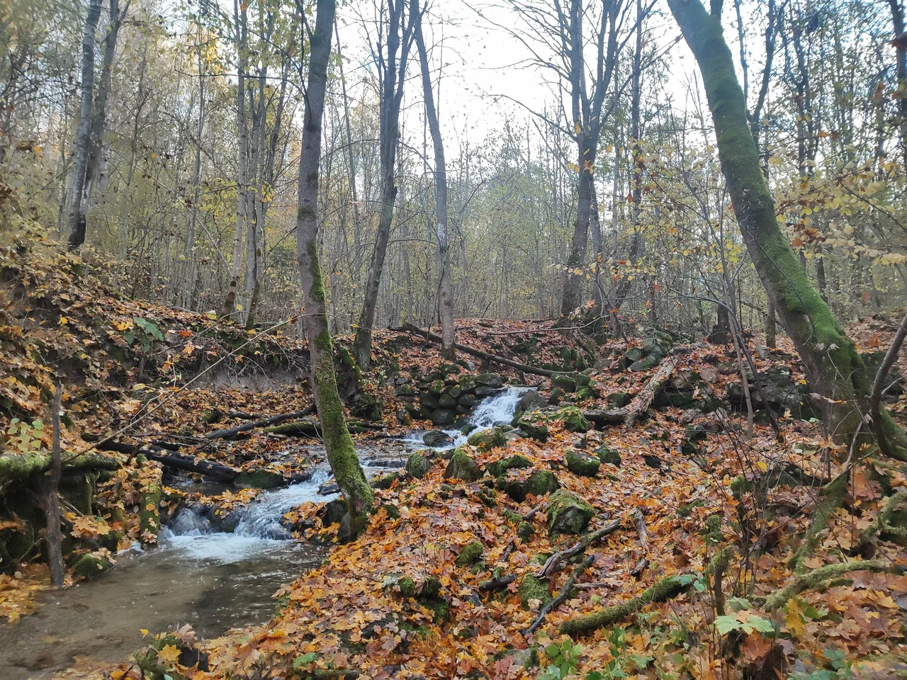
The Melnichny Stream Waterfall (Vodopad na Melnichnom ruchye) is a cascade of small waterfalls on the stream of the same name in the Pskov Oblast, in the Pechory municipal district, about a kilometer and a half from Izborsk. The site lies in a deep ravine known locally as the Melnichnaya gully and forms part of the Izborsko-Malskaya Valley nature monument. The waterfall's coordinates are 57.725944, 27.84652.
The stream's name comes from the water mills that once stood here: the drop in the water level was used to turn their millstones. Remnants of stone foundations from the mills have survived to this day, and old millstones still lie in the streambed close to the waterfall — a reminder of what the place looked like when the mills were still working. Nothing is left of the buildings themselves except these stone pieces, and the stream and the ravine it runs through have since become a natural landmark.
The Izborsko-Malskaya Valley, where the waterfall is located, is known for its mix of karst and erosional landforms. Here, on the border between the Pskov Upland and the Prinarova Lowland, limestone bedrock comes close to the surface, and over the centuries water has cut gullies and ravines into it. Because of this terrain, small streams in the valley often form cascades and stepped drops, and the Melnichny Stream is one of the most notable examples: over a short stretch it descends through several low ledges, which is how the place came to be called a "waterfall". The valley is covered with mixed forest and meadows, while the ravine itself is damper and shadier, with vegetation typical of stream banks.
The waterfall sits close to Izborsk, one of the oldest towns in the Pskov Oblast and home to the famous Izborsk Fortress. The nearby area also includes the Truvorovo hillfort and the Slovenian Springs, so a visit to the Melnichny Stream Waterfall can easily be combined with these sights as part of a walk through the Izborsko-Malskaya Valley. The walking route to the waterfall starts at the foot of the valley, at coordinates 57.714750, 27.855352, and follows the streambed for about 1.5 km to the cascade. The path runs along the bottom of the ravine and is damp in places, so closed footwear is a good idea.
No votes yet


No reviews yet. The first one helps the next travellers.