
Baza U Lukomorya
70.6 km1
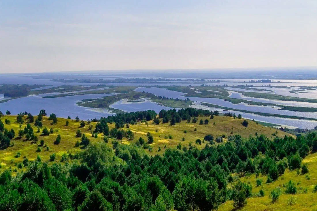
The mouth of the Belaya (Agidel) is the point where this large left tributary of the Kama merges with the Kama itself, on the border between Udmurtia and Bashkortostan. The nearest settlement is the village of Ust-Belsk in the Karakulinsky district of the Udmurt Republic, next to which a nature park of the same name was created.
Before flowing into the Kama, the river spreads out widely, splitting into many channels and islands, and its width here reaches a considerable size — by some accounts, up to 1200 meters. Where the waters of the Belaya and the Kama meet, a natural phenomenon is visible: a pale stripe several kilometers long stretches along the water, formed where the lime-rich water of the Belaya meets the water of the Kama. The area around the mouth is marshy, with floodplain meadows and channels that shift shape from year to year.
The name "Belaya" ("White") is a translation of the Turkic "Ak Idel," meaning "the light, shining river": the same river is called Agidel in Bashkortostan, where it is considered the region's main waterway. According to one local account, the river was called "White" because it flows from the south, "from the sun," and so appears light against other rivers.
According to local legend, the Cossack leaders Stepan Razin and Yemelyan Pugachev hid loot in the Cheganda caves near the mouth — supposedly part of the treasure was collected from ships that once passed through the mouth of the Belaya.
The nature park Ust-Belsk is located at the river mouth. From the hills near the village of Boyarka, on the Udmurt bank, there is a panoramic view over the wide Kama floodplain and the town of Neftekamsk on the opposite bank. Tourist camps and guesthouses operate nearby, including the Belaya River Club, which hosts people paddling the river by kayak and catamaran. Twenty kilometers from the park lies Cape Lyubvi (Cape of Love), another local viewpoint on the Kama's bank.
From the Udmurtia side, reaching the mouth requires a ferry crossing of the Kama, as there is no permanent bridge here. From the highway, about a kilometer of dirt road leads to the bank near the village of Ust-Belsk — a rough, rutted track in places; any car can manage it in dry weather, but passage can be difficult after rain because of the marshy ground.
No votes yet


No reviews yet. The first one helps the next travellers.